

Wildfire Resource Hub – Curry County COAD
Stay safe, stay informed, and access resources
before, during, and after wildfires.
Current Status
-
![]()
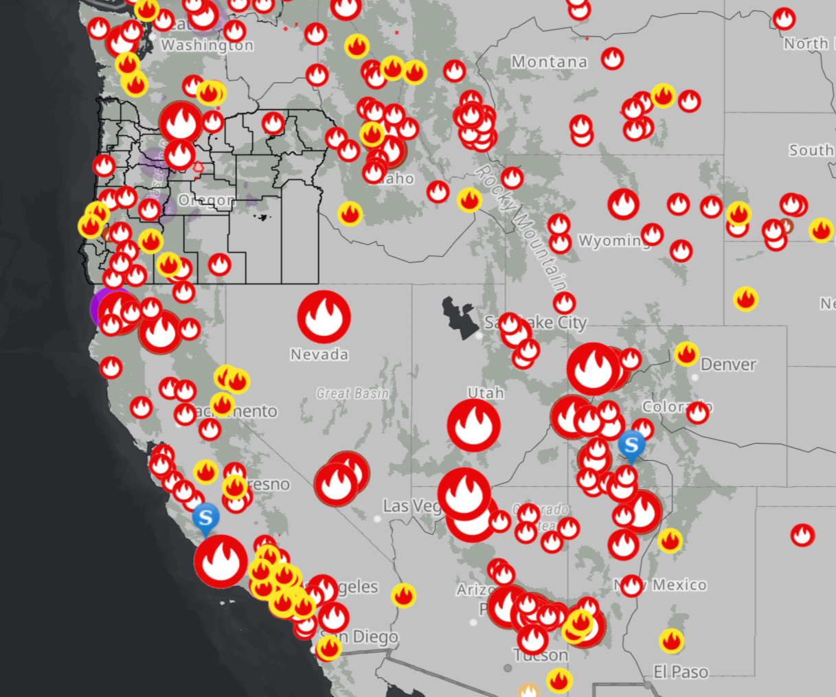
Active Wildfire Map
State of Oregon Fires and Hotspots
-
![]()
Evacuation & Alerts
Sign Up for Emergency Notifications
-
![]()
Air Quality Updates
Oregon’s index


Preparedness
Wildfire Preparedness Checklist
Defensible Space Guide
Home Hardening Tips
Emergency Supply List
During a Wildfire
Follow official evacuation orders immediately
Wear N95 or KN95 masks
Limit outdoor activity
Keep phone charged
Leave early if unsafe
Recovery
Contact Curry County Emergency Mgmt
Apply for FEMA Assistance
Local relief centers
Debris removal resources
Mental health support
Resources & Links
Use this info to prepare ahead, respond quickly, and protect your family, pets, and home.
-
Track heat, lightning, and wind conditions.
National Weather Service – Medford
Fire Weather Outlook (NWS SPC)
-
Breathe easy. Know when it’s time to stay inside or mask up.
AirNow.gov – National air quality map
Oregon Smoke Blog – Local smoke updates
PurpleAir Map – Real-time sensors (scroll to Curry County)
Tip: If air quality is poor (AQI >100), stay indoors, close windows, and run an air filter or DIY box fan.
-
Stay updated on nearby wildfires, evacuation zones, and fire bans.
Oregon Department of Forestry – Southwest District
InciWeb – National incident info
Local Fire Departments – Contact list by region
-
It all begins with an idea. Maybe you want to launch a business. Maybe you want to turn a hobby into something more. Or maybe you have a creative Check before you drive. Fires and smoke can shut down highways.
TripCheck.com – Oregon road conditions and fire impacts
Tip: Always have a backup route planned in case roads are closed during evacuation.
-
Include your animals in your go-plan.
Keep leashes, carriers, and pet food in your go-bag
ID tags and vaccination records should go in your PeaceBox
Pre-arrange shelter options for pets (not all shelters accept them)
-
Know who to contact during outages or Public Safety Power Shutoffs (PSPS).
Pacific Power – Outage map
Coos-Curry Electric – Website
-
Include these in your wildfire section:
Go-bag checklist
Pet evacuation sheet
Home inventory photos (on a flash drive)
Power outage contact list
Local fire dept numbers
-
Description text goes here
-
Description text goes here
-
Description text goes here
-
Description text goes here
-
Description text goes here
-
Description text goes here
-
Description text goes here
-
Description text goes here
-
Description text goes here
Learn More
Changing Fires, Changing Forests: The Effects of Climate Change on Wildfire Patterns and Forests in the Pacific Northwest
https://nwcasc.uw.edu/science/project/changing-fires-changing-forests-the-effects-of-climate-change-on-wildfire-patterns-and-forests-in-the-pacific-northwest/(podcast, fact sheet, data and products, story map)
WatchDuty App
Watch Duty app disseminates public safety information in real-time: https://www.watchduty.org/
Forest Fires in Western Cascadia
Evaluating Drivers and Impacts to Inform Climate-Adaptive Management Responses: https://nwcasc.uw.edu/science/project/forest-fires-in-western-cascadia-evaluating-drivers-and-impacts-to-inform-climate-adaptive-management-responses/ (data and products)
NOAA NIDIS Wildfire Management Interactive Map
This map displays wildfire, air quality and smoke data for the United States alongside a number of climate and drought indicators. Wildfire data is displayed by containment status. https://experience.arcgis.com/experience/8714a2c0922f44b4b336a1a7db6ea085
Monitoring Trends in Burn Severity
Forest Service Climate Change Resource Center:
Northwest Fire Science Consortium https://nwfirescience.org/
National Wildfire Coordinating Group (NWCG)
EcoVis Fire Refugia Map
https://firerefugia-app.forestry.oregonstate.edu/projects/v3/